
“U.S. Counties Created or Abolished, 1920-1983,” by William Dollarhide
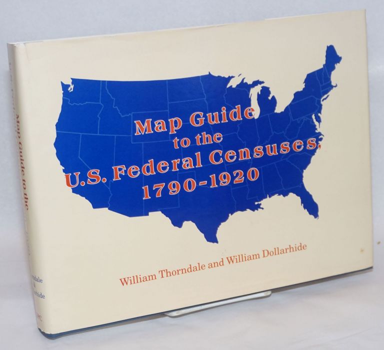
The following list of counties was derived from Map Guide to the U.S. Federal Censuses, 1790-1920, by William Thorndale and William Dollarhide (Baltimore: Genealogical Publishing Co., Inc., 1987). The original purpose of the Map Guide was to show the evolution of county boundaries from one federal census to the next; to allow a better understanding of the genealogy of the county jurisdictions; and to lead a researcher to the location of the correct modern county courthouse where records for an ancestor may be stored today. All county boundaries and name changes, 1790-1920, can be seen graphically on its maps, and all county names (modern, obsolete, or extinct counties) are included in the book’s county index, with a reference to a map zone for a location. Only those few counties that were created and abolished between any two federal census years–those never appearing on any federal census–are omitted from the Map Guide. The modern counties are complete through 1987, the year the Map Guide was first published.
Since the period of coverage for the Map Guide ends with 1920, researchers have raised questions concerning changes in counties and county boundaries made after that year. The list below includes the names of the counties created after the 1920 federal census, as well as counties abolished after 1920. This list can be used to determine the counties appearing (or not appearing) in the 1930 or later federal censuses.
Since the 1790-1920 maps in the book show the underlying modern boundaries for all U.S. counties, any county created after 1920 is easy to find Map Guide on the maps. The list assembled for this article can be construed as an addendum to the MAP GUIDE, bringing the volume up to date to the federal census of 1990, which, according to current federal privacy policies, should be made public in the year 2062.
The following list includes changes to Virginia’s counties and independent cities since 1920; however, other county mergers, city/county consolidations, and “unified governments” are not identified. This trend of consolidation began in 1963 when the city of Nashville and Davidson County, Tennessee, merged into one government, marking the first major U.S. city to form a “metropolitan government.” Since then, about 20 city/county consolidations, mergers, or joint government operations have taken place. There are at least that many city/county consolidations under consideration and awaiting a vote by the local citizenry. About a dozen county mergers have also occurred since 1990, where two or more counties have joined together to form a single government. Most of these jurisdictional changes have taken place after 1990. Please keep in mind that the “new counties, abolished counties” list ends with La Paz County, Arizona, which was created in 1983.
States with New Counties, Abolished Counties, or Independent Cities since the Census Day of 1 June 1920:
Arizona: one new county
- La Paz County created from Yuma in 1983 (the last county created in the U.S.)
Florida: 13 new counties
- Charlotte County created from DeSoto in 1921
- Dixie County created from Lafayette in 1921
- Glades County created from DeSoto in 1921
- Hardee County created from DeSoto in 1921
- Highlands County created from DeSoto in 1921
- Sarasota County created from Manatee in 1921
- Union County created from Bradford in 1921
- Collier County created from Lee and Monroe in 1923
- Hendry County created from Lee in 1923
- Gilchrist County created from Alachua in 1925
- Gulf County created from Calhoun in 1925
- Indian River County created from St. Lucie in 1925
- Martin County created from Palm Beach and St. Lucie in 1925
Georgia: six new counties; two abolished counties
- Brantley County created from Charlton, Pierce, and Wayne in Nov 1920
- Lamar County created from Monroe and Pike in Nov 1920
- Lanier County created from Berrien, Lowndes, and Clinch effective Nov 1920
- Seminole County created from Decatur and Early in Nov 1920
- Long County created from Liberty in Nov 1920
- Peach County created from Houston and Macon in 1924
- Campbell and Milton counties were abolished in 1932, their areas both annexed to Fulton
Montana: five new counties
- Daniels County created from Valley and Sheridan in 1920
- Golden Valley County created from Musselshell in 1920
- Judith Basin County created from Fergus and Cascade in 1920
- Lake County created from Flathead and Missoula in 1923
- Petroleum County created from Fergus and Garfield in 1924
Nevada: one significant county boundary change
- The indefinite 1861 Washoe eastern boundary was finally defined by range/township in 1924, impacting the adjoining counties of Humboldt and Pershing
New Mexico: four new counties
- Catron County created from Socorro in 1921
- Harding County created from Mora and Union in 1921
- Los Alamos County created from Sandoval and Santa Fe in 1949
- Cibola County created from Valencia in 1981
South Dakota: two abolished counties
- Armstrong County was enumerated with Dewey, 1920-1950, but not officially annexed to Dewey until 1952
- Washington County was abolished and the area annexed to Shannon County in 1943
Texas: one significant county boundary change
- Willacy County migrated south one county in 1921; the area of 1920 Willacy is identical today to Kenedy County, except for a 1.4 mile strip below the southern boundary of Kenedy
Virginia: new independent cities and abolished counties
- Independent cities have existed in Virginia since Williamsburg was chartered in 1722. In 1987, 41 independent cities were outside county boundaries and jurisdictions. Three are now defunct:
1) Manchester, incorporated in 1874 and absorbed into Richmond in 1910
2) South Norfolk, incorporated in 1921 and merged with Norfolk County in 1962 to form the city of Chesapeake
3) Warwick County became the City of Warwick in 1952 and then was absorbed into the city of Newport News in 1957; these changes abolished the counties of Norfolk and Warwick
- Also extinct are Elizabeth City County, which merged with the city of Hampton in 1952, and Princess Anne County, which was consolidated with the city of Virginia Beach in 1962
City/County Changes Since 1987
Genealogists who expect to be around in 2072 to review the 2000 census in person will find many county changes impacting the place of residence of their ancestors. An excellent review of the many city/county changes can be found at the Wikipedia page. That article includes a detailed list of city/county consolidations and mergers and county/county mergers.
A Trio of Terrific Census Reference Books
The Map Guide to the U.S. Federal Censuses, 1790-1920, mentioned above, is one of three census finding aids that are easily the most valuable books on their subjects. These esteemed publications show you how to navigate the U.S. census, discover hidden state censuses, and uncover colonial censuses that precede the state and federal enumerations. Read on for details.
Map Guide to the U.S. Federal Censuses, 1790-1920
Whether because of political gerrymandering, annexation, or some other reason, county boundaries–like ward boundaries–were subject to frequent change. For example, the boundaries of both Somerset and Worcester counties on Maryland’s Eastern Shore changed between 1860 and 1870 to make room for the new county of Wicomico. Between 1850 and 1860, the eastern part of Yalobusha County, Mississippi, became part of Calhoun County. Ten years later, the southern part of Yalobusha could be found in Grenada County.
As the previous article by William Dollarhide demonstrates, throughout the history of the U.S., county boundaries changed from one decennial census to the next, especially before 1900. The best way to know if you’re looking in the right county as you scroll through the census is to consult the Map Guide by William Thorndale and William Dollarhide. State by state, this highly acclaimed reference work maps out county boundaries for every census from 1790 through 1920 and superimposes modern county boundaries overtop of them. Don’t be lost in the census without it! View Book
American Population Before the Federal Census of 1790
Few books published over 70 years ago are just as useful to the genealogist today as they were in 1932; however, this work, based upon both primary and secondary sources, is nothing less than a comprehensive survey, arranged by colony, state, or territory–and chronologically thereunder–of population lists for all units of American government in existence as of 1790. The lists themselves range from poll lists, tax lists, taxables, militia lists, and censuses; the book’s geographical coverage extends to Connecticut, Delaware, Georgia, Kentucky, Maryland, Massachusetts, New Hampshire, New Jersey, New York, North Carolina, Pennsylvania, Rhode Island, South Carolina, Tennessee, Vermont, Virginia, the Illinois Territory, and the Northern and Southern Departments of the Western Indians. View Book
State [as Opposed to Federal] Census Records
State census records, unlike federal censuses, are among the most under-used (yet extremely valuable) of all genealogical records. It’s a fact that state governments have also carried out censuses randomly throughout their history to satisfy a variety of purposes, notwithstanding the decennial federal ones . Michigan, for example, took a special Civil War veterans census in 1888. There are also surviving territorial censuses that were taken to demonstrate readiness for statehood.
These state censuses are invaluable to genealogists because they fill in gaps left by missing federal censuses. For example, 12 states conducted censuses between 1885 and 1895, any one of which can substitute for that state’s missing 1890 federal census. Many state censuses contain information not found in federal censuses because the census takers asked different questions. For all of these reasons, state censuses can give you a more complete picture of your ancestors and solve genealogical problems. To find out what state censuses exist, what kinds of information they contain, and where they can be found, read State Census Records, by Ann Lainhart, the definitive guide to this major, though vastly under-used, genealogical resource. View Book