
Editor’s note: The following post on the importance of knowing the county in order to properly utilize census records, and how shifting boundaries can affect that search, is written by author William Dollarhide. An excellent source that can be used to visualize the county boundaries for every county in the U.S. and for each census year is the book by William Thorndale and William Dollarhide, Map Guide to the U.S. Federal Censuses, 1790-1920. This book has 393 maps showing each applicable census year and all county boundary changes from 1790 to 1920. Each map shows both the old boundaries and the modern boundaries for each state and census year, so a comparison can be made.
Census Records and County Boundary Changes
All censuses taken since 1790 are tabulated and organized by the counties within each state or territory. By federal precedence, the county is the basic unit of jurisdiction for census demographics. Alaska is the only state without counties; therefore, judicial districts are used as jurisdictions for the censuses taken there. In Louisiana, the term “parish” is used in the same way as “county” in other states. Even in the New England states–where a town may have more importance than a county as a genealogical resource–censuses are organized by county.
Interestingly, Connecticut abolished county government in 1960. All county functions were taken over by the towns or by the state, except that the county boundaries were retained expressly for the purpose of taking a census and certain other statistical studies based on a county, rather than town boundaries.
Between 1790 and 2000, 138 counties reported in the censuses have been renamed or abolished and subsequently absorbed into other counties. Through 1920, 44 cities in Virginia were independent of any county.
Genealogists learn early the importance of the county as a jurisdiction when using the U.S. federal censuses because one needs to know the county before one can find a resident in a certain locale. Finding the right county is a big step in genealogical research, not only because of census records but also because of the many other records specific to a certain county or locality.
County Boundary Changes
When using census records for genealogical research, researchers need to understand how county boundaries have changed over the years. Understanding the genealogy of counties is part of locating the place where an ancestor lived.
For example, if a genealogist knows that an ancestor lived in Allegheny County, Pennsylvania, in 1790, that county’s courthouse is a resource for old deeds, marriages, and other court records. By 1800, nine new counties had been created from old Allegheny County, covering the same area: Allegheny, Beaver, Butler, Crawford, Erie, Mercer, and parts of Armstrong, Venango, and Warren counties.
Another example of county boundary changes occurred in Oregon. In 1850, marriages in the little town of Linkville in Linn County were recorded in Albany, the county seat. By 1860, due to the formation of new counties, marriages performed in Linkville, now in Wasco County, were recorded in The Dalles; in 1870, marriages performed in Linkville were recorded in Jacksonville, the county seat of Jackson County (but later the county seat was moved to Medford); in 1880, marriages performed in Linkville were recorded in Lakeview, the county seat of Lake County; and in 1890 marriages performed in Linkville were recorded there because Linkville had become the county seat of Klamath County–but then the name Linkville was changed to Klamath Falls. The boundaries of Klamath County have not changed since 1890.
Of course, the town of Linkville never moved. As the settlement of Oregon took place, new counties were created, and earlier county boundaries were changed, placing the town of Linkville-Klamath Falls in five different counties from 1850 through 1890. Therefore, all county records such as deeds, probates, marriages, etc., for a family that lived in Linkville, Oregon, are spread across the state and stored today in five different county courthouses.
These examples can be repeated in virtually every state. Genealogists attempting to identify the places their ancestors lived must first face the reality of changing county boundaries over the years.
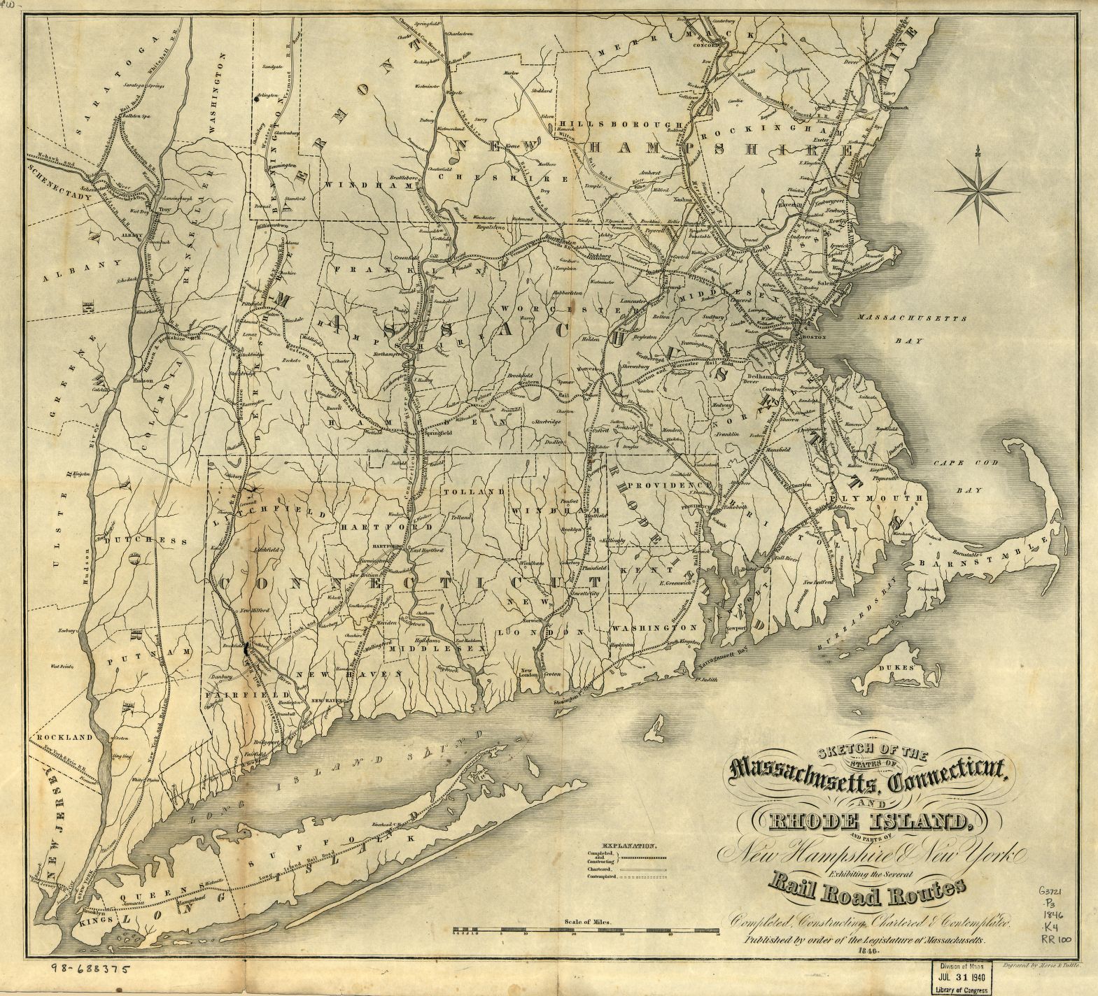
Image credit: Sketch of the states of Massachusetts, Connecticut, and Rhode Island, and parts of New Hampshire & New York exhibiting the several rail road routes completed, constructing, chartered & contemplated; published by order of the Legislature of Massachusetts, 1846. Contributed by Kennedy, Archibald, active 1850. Care of Library of Congress Geography and Map Division.